| This map is found on Mapicurious.com | Download these points of interest directly into your favorite GPS or other geo software | |||
|
|||
| Use the zoom controls on the map to adjust the map's viewable area then print: | |||
| LOCATIONS highlighted on this map: |
|
lat:34.16575 Click the link for pictures of Bartow County markers.
lat:34.2852167 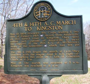
Halls Station Road 3.6 miles north of Ga 293
lat:34.3671833 
lat:34.2338 
Atlanta Campaign Cassville USDI Pavillion at US 41 and road to Cassville from south
lat:34.3017 
lat:34.16575 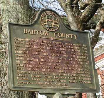
lat:34.2489 
lat:34.2507667 
lat:34.2491667 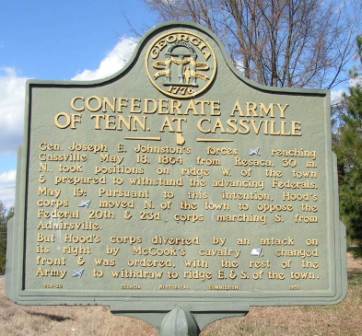
lat:34.2391833 
lat:34.2366667 
lat:34.1429167 
lat:34.3668833 
lat:34.22665 
lat:34.2609167 
lat:34.2507333 
lat:34.2384333 
lat:34.23525 
lat:34.3668833 
lat:34.2352833 
lat:34.3668833 
lat:34.3978167 
lat:34.0874167 
lat:34.2491667 
lat:34.2581333 
|


|
Although the author has taken all reasonable care in preparing this guide, Mapicurious and the author make no warranty about the accuracy or completeness of its content and accept no responsibility for any loss, injury, or inconvenience arising from its use. |