| This map is found on Mapicurious.com | Download these points of interest directly into your favorite GPS or other geo software | |||
|
|||
| Use the zoom controls on the map to adjust the map's viewable area then print: | |||
| LOCATIONS highlighted on this map: |
|
lat:34.16575 Click the link for pictures of Bartow County markers.
lat:34.260641 
Photographer:
lat:34.44110 
Photographer:
lat:34.260641 
Photographer:
lat:34.260641 
Photographer:
lat:34.260641 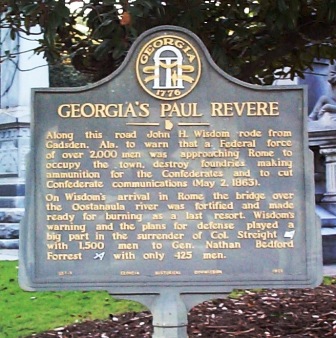
Photographer:
lat:34.345313 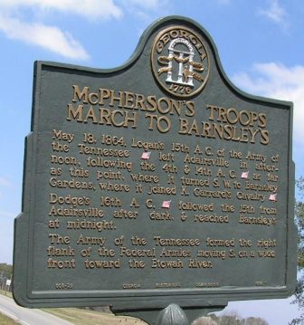
lat:34.1742167 ** Picture unavailable
lat:34.109333 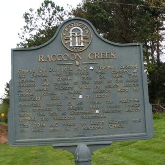
lat:34.101847 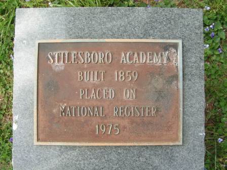
See what stands where once the Blue & Gray fought. Click on the Website link.
lat:34.2350833 
lat:34.2360167 
lat:34.102683 
lat:34.2385167 
lat:34.2489 
lat:34.2307667 
|


|
Although the author has taken all reasonable care in preparing this guide, Mapicurious and the author make no warranty about the accuracy or completeness of its content and accept no responsibility for any loss, injury, or inconvenience arising from its use. |