| This map is found on Mapicurious.com | Download these points of interest directly into your favorite GPS or other geo software | |||
|
|||
| Use the zoom controls on the map to adjust the map's viewable area then print: | |||
| LOCATIONS highlighted on this map: |
|
lat:32.86931 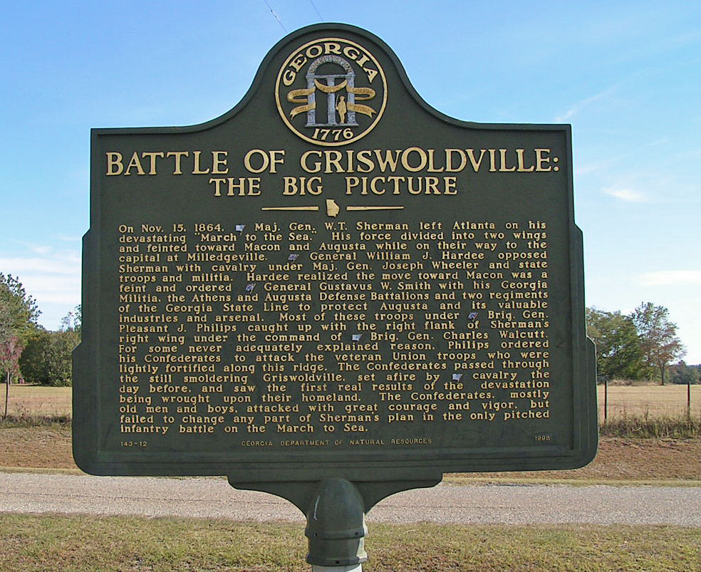
At Griswoldville Monument on Baker Rd off GA 57 via Ridge Rd/Henderson Rd. and Old Griswoldville Rd. 11/10/2007 [32.86931, -83.46004]
lat:34.03838 
Ga 211 about 5 miles northwest of Winder
lat:31.49242 
US 17/Ga 25 8.8 miles north of Darien 11/10/2007 [31.49242, -81.44489]
lat:31.07064 
Riverview Dr, south of Horton house by airport, Jekyll Island 11/8/2007 [31.07064, -81.42629]
lat:31.64010 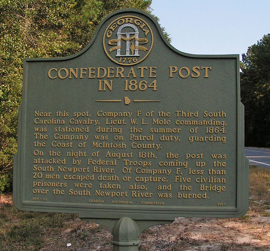
US 17/Ga 25, 0.2 mi S of the South Newport River, S. Newport 11/10/2007 [31.64010, -81.39475]
lat:33.95700 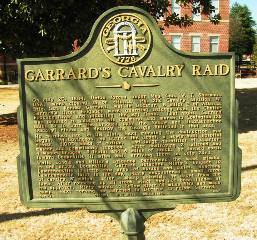
Old Courthouse in Lawrenceville
lat:31.840487 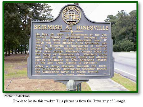
US 84/GA 38 near junction with GA 196 (Ryon Ave.), Hinesville 11/10/2007 [31.840487, -81.594679]
lat:31.36908 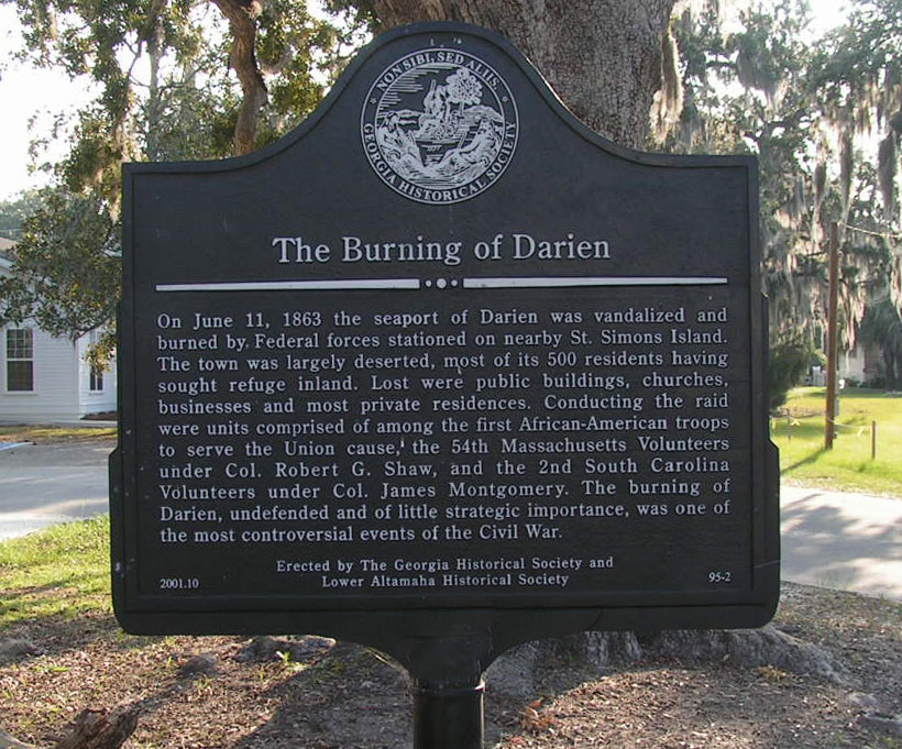
1 block E. of US 17, Darien 11/10/2007 [31.36908, -81.43439]
lat:33.99215 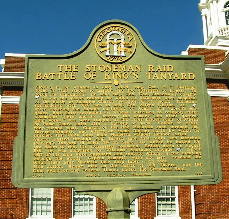
Courthouse in Winder (2/28/07) [33.99215N, 83.72141W] |


|
Although the author has taken all reasonable care in preparing this guide, Mapicurious and the author make no warranty about the accuracy or completeness of its content and accept no responsibility for any loss, injury, or inconvenience arising from its use. |