| This map is found on Mapicurious.com | Download these points of interest directly into your favorite GPS or other geo software | |||
|
|||
| Use the zoom controls on the map to adjust the map's viewable area then print: | |||
| LOCATIONS highlighted on this map: |
|
lat:33.75431694675655 Click here to visit 11 pages of Fulton County markers.
lat:33.842847 
The DuBose Civil War Collection
lat:33.793223 
Piedmont Rd at Westminster Dr, Piedmont Park, Atlanta
lat:33.56002 
Bethsaida Road at the Fulton/Clayton County line (12/6/07) [33.56002, -84.45943]
lat:33.793885 
North Highland and Zimmer Drive NE, Atlanta
lat:33.51747 
Confederate Monument on US 29 (Main St), Palmetto (12/6/07) [33.51747, -84.66961]
lat:33.814167 
DeFoors Ferry Rd at Bohler Rd, Atlanta (6/27/05) [33.814167N, 84.427217W]
lat:33.803056 
Chattahochee Ave and Carroll Dr, Atlanta (6/27/05) [33.803056N, 84.432225W]
lat:33.788062 
Johnson Rd just west of Perry Blvd and Marietta Rd, Atlanta
lat:33.790276 
Howell Mill Rd at Bishop St, Atlanta (6/27/05) [33.790276N, 84.411952W]
lat:33.753613 
1116 Boulevard Drive, Atlanta (8/11/05) [33.753613N, 84.350560W]
lat:33.907739 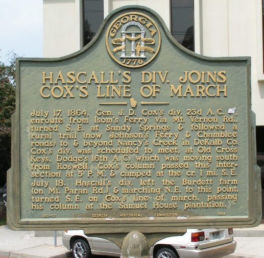
Johnson Ferry Rd immediately east of Ga 400 overpass (8/18/2004) [33.907739N, 84.356373W]
lat:33.748611 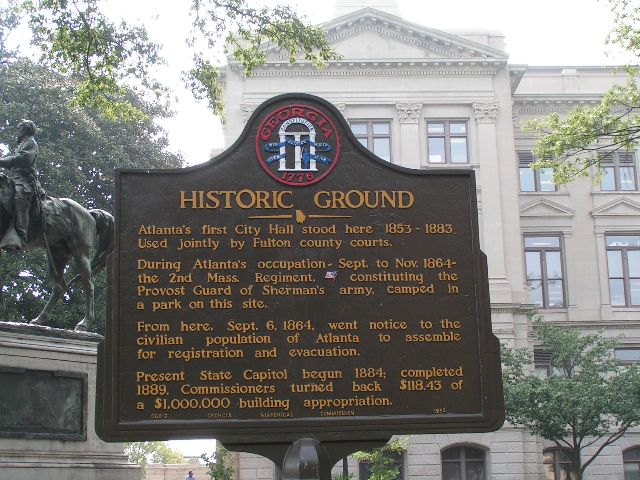
Washington St. on NW corner of State Capitol Square, Atlanta (8/20/04) [33.748611N, 84.388328W]
lat:33.56066 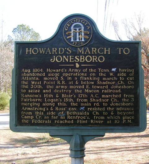
Bethsaida Rd E of Old National Hwy near Fulton-Clayton line (12/6/07) [33.56066, -84.46084]
lat:33.794446 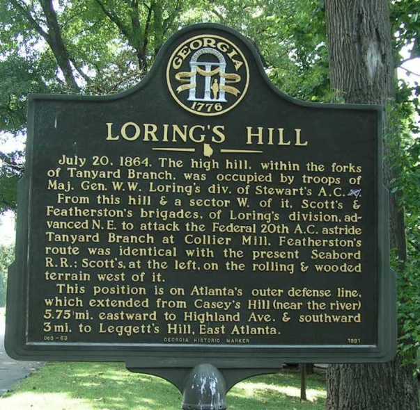
Trabert Ave just east of Northside Dr (6/27/05) [33.794446N, 84.406121W]
lat:33.810279 
Howell Mill Rd at Norfleet Dr, Atlanta (6/27/05) [33.810279N, 84.412779W]
lat:33.812639 
Northside Dr at Overbrook Dr, Atlanta (12/22/04) [33.812639N, 84.407426W]
lat:33.610936 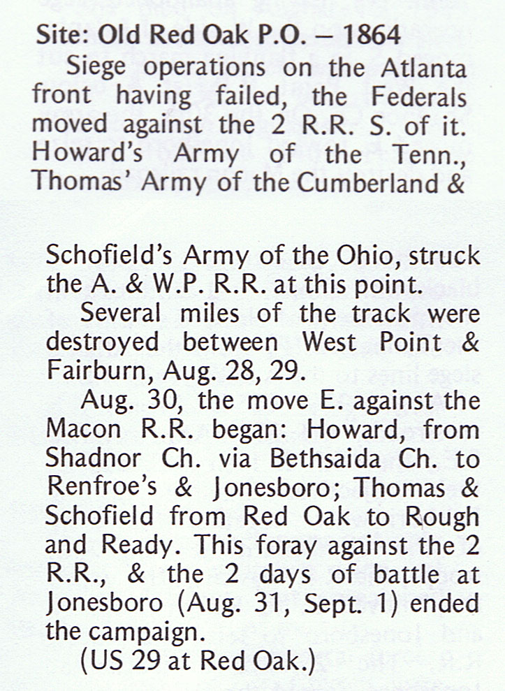
US 29 (Roosevelt Hwy) at Welcome All Rd, Red Oak Marker is missing. (12/6/07) [33.610936, -84.523626)
lat:33.797499 
Fork of Johnson and Lenox Rds, Atlanta (6/30/05) [33.797499N, 84.349727W]
lat:33.808056 
Channing Dr just east of Howell Mill Rd, Atlanta
lat:33.867514 
Powers Ferry Rd just south of Nancy Creek bridge, Atlanta (8/19/2004) [33.867514N, 84.392785W]
lat:33.801388 
Piedmont Ave at East Pelham Rd, Atlanta 6/30/05) [33.801388N, 84.367501W] |


|
Although the author has taken all reasonable care in preparing this guide, Mapicurious and the author make no warranty about the accuracy or completeness of its content and accept no responsibility for any loss, injury, or inconvenience arising from its use. |