| This map is found on Mapicurious.com | Download these points of interest directly into your favorite GPS or other geo software | |||
|
|||
| Use the zoom controls on the map to adjust the map's viewable area then print: | |||
| LOCATIONS highlighted on this map: |
|
lat:33.775662 Click the link for DeKalb County pictures.
lat:33.7450167 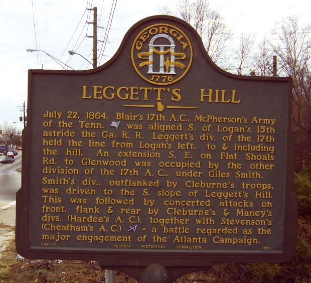
Moreland Avenue at I-20 overpass (2/7/05)
lat:33.7611111 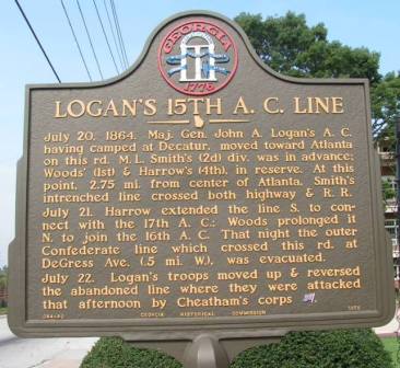
DeKalb Avenue between Candler and Ferguson Streets (8/11/05)
lat:33.8494444 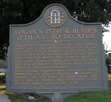
Briarcliff and Henderson Mill Roads (7/23/05)
lat:33.9211111 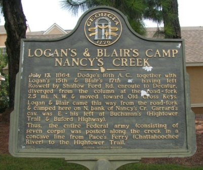
N. Shallowford Rd just north of I-285 Frontage Road (8/18/05)
lat:33.8530556 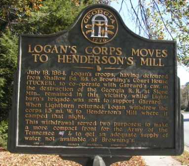
LaVista Rd at Midville Rd, west of Tucker (11/18/05)
lat:33.9468667 
Chamblee-Dunwoody at Nandina Lane, Dunwoody (1/31/05)
lat:33.7476667 
Memorial Drive near East Side Ave, East Atlanta (2/10/05)
lat:33.7478833 
Memorial Drive at Dixie Street, East Atlanta (2/10/05)
lat:33.7619444 
DeKalb Avenue at Whitefoord Avenue (8/11/05)
lat:33.8921167 
Johnson Ferry Rd at Ashford-Dunwoody Dr (2/25/05)
lat:33.7611111 
DeKalb Avenue at Elmira Place (8/11/05)
lat:33.7473333 
Memorial Drive near Clay St, East Atlanta (2/10/05)
lat:33.863672 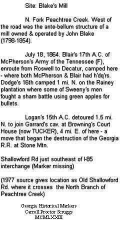
A shopping center has been built on this site. The marker is missing. (1977 source gives location as Old Shallowford Rd. where it crosses the North Branch of Peachtree Creek)
lat:33.7016667 
1510 Key Rd at Entrenchment Creek Water Plant (8/18/05)
lat:33.7963889 
1484 Clairmont Road (11/18/05)
lat:33.8147222 
Briarcliff Rd south of LaVista Road (6/30/05)
lat:33.765 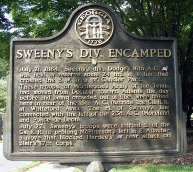
1500 block of McLendon Ave, in Candler Park (8/18/05)
lat:33.7531333 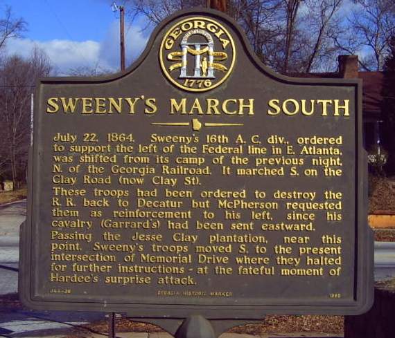
Clay Street south of Boulevard Drive, East Atlanta (2/10/05)
lat:33.7397 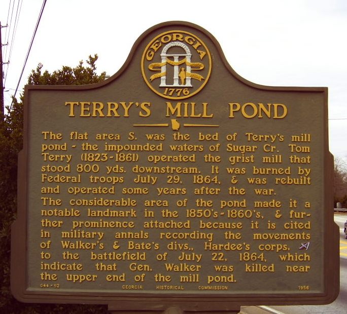
Glenwood Avenue just east of I-20 interchange (2/7/05)
lat:33.8127778 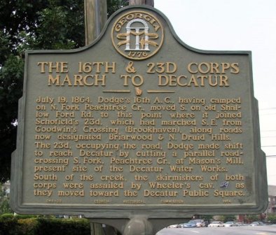
Just east of Clairmont and N. Druid Hills Road intersection (8/18/05)
lat:33.8494444 
Briarcliff and Henderson Mill Roads (7/23/05)
lat:33.8852778 
Shallowford Road at Carroll Avenue (8/18/05)
lat:33.7280556 
Fayetteville Rd just north of Pine Trail at Sugar Creek (8/18/05)
lat:33.7475333 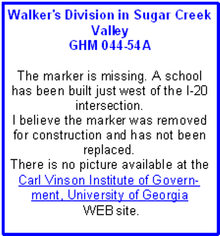
Glenwood Ave just west of I-20 interchange (2/10/05) |


|
Although the author has taken all reasonable care in preparing this guide, Mapicurious and the author make no warranty about the accuracy or completeness of its content and accept no responsibility for any loss, injury, or inconvenience arising from its use. |