| This map is found on Mapicurious.com | Download these points of interest directly into your favorite GPS or other geo software | |||
|
|||
| Use the zoom controls on the map to adjust the map's viewable area then print: | |||
| LOCATIONS highlighted on this map: |
|
lat:33.751022 Click on the link to visit 10 pages of pictures.
lat:33.81086 Click on this link for a page of pictures. Collier Rd. at Overbrook Dr. in park.
lat:33.826222 
lat:33.752676 
lat:33.817359 
The marker is missing. This is the text.
lat:33.760151 Could not find marker. This picture is from UGA.
lat:33.825939 
lat:33.8102667 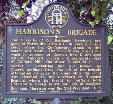
lat:33.867594 
lat:33.88863 
lat:33.826222 
lat:33.806180 
lat:33.801462 
Marker is missing.
lat:33.801462
Marker is missing.
lat:33.857711 
lat:33.7584 
lat:33.7593 
lat:33.9003167 
lat:33.8179333 
lat:33.81485 
lat:33.7496833 
lat:33.81345 
lat:33.867594 
lat:33.8062833 
lat:33.8179333 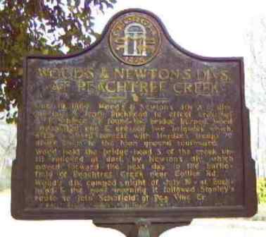
|


|
Although the author has taken all reasonable care in preparing this guide, Mapicurious and the author make no warranty about the accuracy or completeness of its content and accept no responsibility for any loss, injury, or inconvenience arising from its use. |