| This map is found on Mapicurious.com | Download these points of interest directly into your favorite GPS or other geo software | |||
|
|||
| Use the zoom controls on the map to adjust the map's viewable area then print: | |||
| LOCATIONS highlighted on this map: |
|
lat:35.96717 
A large Federal earthwork was located back of Vine Avenue between Gay and Walnut Streets when General James Longstreet besieged Knoxville, Nov. 17-Dec. 4, 1863. The Federal defense line ran along this ridge from Fort Hill, (Surrey St. and Saxton Ave.) 2400 yards east, to Fort Sanders, (17th St. and Laurel Ave.) 1400 yards west. Ten forts crowned these heights, five east and four west of this point.
lat:35.96127 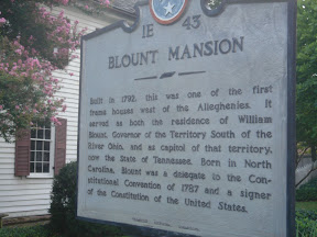
Built in 1792, this was one of the first frame houses west of the Alleghenies. It served as both the residence of William Blount, Governor of the Territory South of the River Ohio, and as capitol of that territory, now the State of Tennessee. Born in North Carolina, Blount was a delegate to the Constitutional Convention of 1787 and a signer of the Constitution of the United States.
lat:36.02700 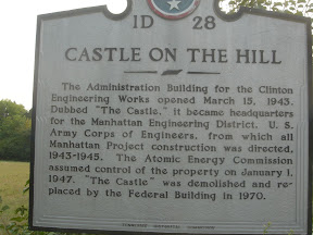
The Administration Building for the Clinton Engineering Works opened March 15, 1943. Dubbed "The Castle," it became headquarters for the Manhattan Engineering District, U.S. Army Corps of Engineers, from which all Manhattan Project construction was directed, 1943-1945. The Atomic Energy Commission assumed control of the property on January 1, 1947. "The Castle" was demolished and replaced by the Federal Building in 1970.
lat:35.96525 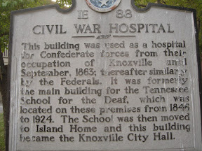
This building was used as a hospital for Confederate forces from their occupation of Knoxville until September, 1863; thereafter similarly by the Federals. It was formerly the main building for the Tennessee School for the Deaf, which was located on the premises from 1846 to 1924. The School was then moved to Island Home and this building became the Knoxville City Hall.
lat:35.966750 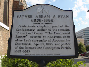
Confederate chaplain, poet of the Confederacy, author of the requiem of the Lost Cause, "The Conquered Banner," written at Knoxville soon after Lee's surrender at Appomattox Courthouse, April 9, 1865, and pastor of the Immaculate Conception Parish, 1865-1867.
lat:35.95790 
"The Hill," dear to University of Tennessee alumni, was protected by a battery of Federal cannon and a brigade of infantry during Longstreet's siege of Knoxville, in Nov., 1863. A line of entrenchments ran across the west and south slopes of the hill, connecting Fort Sanders and Second Creek.
lat:35.95740 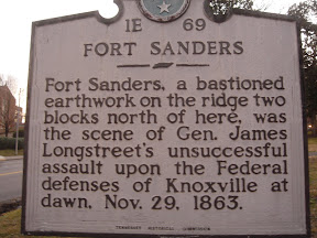
Fort Sanders, a bastioned earthwork on the ridge two blocks north of here, was the scene of Gen. James Longstreet's unsuccessful assault upon the Federal defenses of Knoxville at dawn, Nov. 29, 1863.
lat:35.94945 
Fort Dickerson to the west and Fort Stanley to the east were the center two of four fortified heights held by the Federals south of the river during the siege of Knoxville, Nov. 17-Dec. 4, 1863. Maj. Gen. Jos. Wheeler, C.S.A., made a vain effort to seize these hills with cavalry Nov. 15-16. He came via Sweetwater and Maryville.
lat:35.95812 
Born in Cates Landing, Tennessee, on August 31, 1893, Clifton B. Cates attended school in Tiptonville and the Missouri Military Academy in Mexico, Missouri. While excelling in varsity football and baseball, he received his law degree from the University of Tennessee in 1916. His early Marine service included combat commander duties in World War I and World War II. Wounded seven times in World War I, Cates received over thirty American and foreign medals. In 1942, he led the First Marine Regiment, First Marine Division on Guadalcanal. (Continued on other side) - SORRY - no other side pic.
lat:35.95812 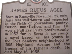
Born in Knoxville November 27, 1909, Agee was well-known and respected in the fields of journalism, poetry, fiction, non-fiction, and film. He won a Pulitzer Prize posthumously in 1957 for A Death in the Family, a novel based on his youth in the Fort Sanders neighborhood at 1505 Highland Avenue and the trauma of his father's death. He died May 16, 1955.
lat:35.71208333 
lat:35.96507 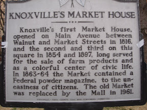
Knoxville's first Market House, opened on Main Avenue between Walnut and Market Streets in 1816, and the second and third on this square in 1854 and 1897, long served for the sale of farm products and as a colorful center of civic life. In 1863-64 the Market contained a Federal powder magazine, to the uneasiness of citizens. The old Market was replaced by the Mall in 1961.
lat:35.949833 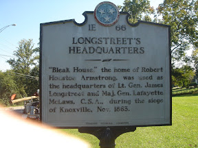
"Bleak House," the home of Robert Houston Armstrong, was used as the headquarters of Lt. Gen. James Longstreet and Maj. Gen. Lafayette McLaws, C.S.A., during the siege of Knoxville, Nov. 1863.
lat:35.95975 
On this site stood the home of Dr. James Gettys McGready Ramsey, physician, civic leader, statesman and author of the Annals of Tennessee, who live here from 1872 until his death in 1884. It was named for Dr. Ramsey's first home, Mecklenburg, at the junction of the French Broad and Holston rivers, which was destroyed by fire during the Federal occupation of the region.
lat:35.99382 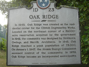
In 1943, Oak Ridge was created as the residential center for the Clinton Engineering Works. Located on the northeast corner of a 59,000 acre reservation acquired by the government in 1942, the community was designed by Skidmore, Owings, and Merrill, Architects. In 1945, Oak Ridge reached peak population of 75,000. On January 1, 1947, the Atomic Energy Commission assumed control of the community. In 1959, Oak Ridge became an incorporated municipality.
lat:35.913436091900735 
One mile south, Charles McClung erected his brick home about 1806. McClung laid out the city of Knox-ville in 1791 on the site of White's Fort, was on the committe to draft Tennessee's first Constitution, and was a charter trustee of Blount College, now the University of Tennessee. The house was partially destroyed by fire and rebuilt in 1823.
lat:35.95898 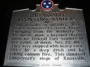
Four brigades of infantry, Gen. James Longstreet's First Corps, emerging from the declivity to the north, made a bayonet charge upon the Federal Fort Sanders at this point, at dawn, Nov. 29, 1863. They were stopped with heavy casualties by a deep ditch and by raking cannon fire. This climaxed Longstreet's siege of Knoxville.
lat:36.01282 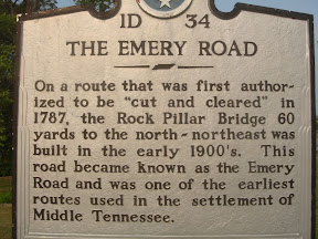
On a route that was first authorized to be "cut and cleared" in 1787, the Rock Pillar Bridge 60 yards to the north-northeast was built in the early 1900's. This road became known as the Emery Road and was one of the earliest routes used in the settlement of Middle Tennessee.
lat:35.98425 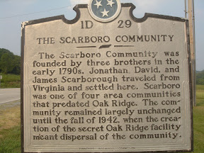
The Scarboro Community was founded by three brothers in the early 1790s. Jonathan, David, and James Scarborough traveled from Virginia and settled here. Scarboro was one of four area communities that predated Oak Ridge. The community remained largely unchanged until the fall of 1942, when the creation of the secret Oak Ridge facility meant dispersal of the community. |


|
Although the author has taken all reasonable care in preparing this guide, Mapicurious and the author make no warranty about the accuracy or completeness of its content and accept no responsibility for any loss, injury, or inconvenience arising from its use. |