| This map is found on Mapicurious.com | Download these points of interest directly into your favorite GPS or other geo software | |||
|
|||
| Use the zoom controls on the map to adjust the map's viewable area then print: | |||
| LOCATIONS highlighted on this map: |
|
lat:33.176105 at Ben Hill School on Ga. 11 in Hillsboro, Ga. Placement is approximate. I have not visited the site. DRH
lat:33.325540 
Eatonton-Putnam Co. Hist. Society on U.S. 441 at Courthouse, Eatonton
lat:33.085340 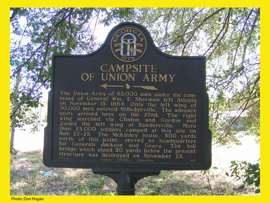
Old River Bridge Rd at Ga 22/24, east of Oconee River Hidden in bushes and trees
lat:33.121070 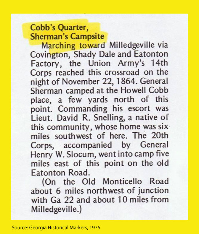
Old Monticello Rd and Nelson Rd, about 6 miles NW of GA 22
lat:33.326160 
Courthouse in Eatonton W. Marion & Madison
lat:33.304419 
Square in Monticello
lat:33.080280 
East Greene Street at Jefferson Street, Milledgeville
lat:33.121070 
Old Monticello Rd and Nelson Rd, about 6 miles NW of GA 22
lat:33.304764 
Courthouse in Monticello
lat:33.095950 
GA 22 at junction with GA 212
lat:33.079600 
South Clark St south of Hancock St, Milledgeville
lat:33.081440 
West Hancock and Jefferson Streets, Milledgeville
lat:33.080120 East Greene Street at Jefferson Street, Milledgeville Marker missing. Construction on the site.
lat:33.326080 
Courthouse in Eatonton
lat:33.078210 
West Greene and North Jackson Streets, Milledgeville
lat:33.082540 
North Clark St south of Montgomery St, Milledgeville Marker missing. Museum built on this corner. Read the text.
lat:33.079700 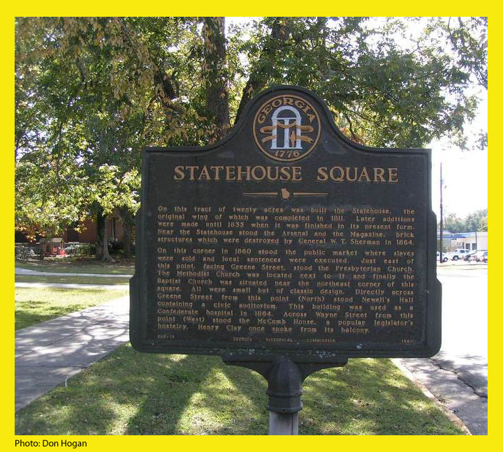
South Wayne and East Greene Streets, Milledgeville
lat:33.081130 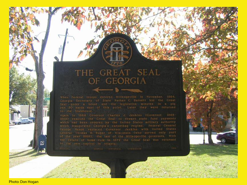
Courthouse, Hancock and Wilkinson Streets, Milledgeville
lat:33.082548 
North Clark St south of Montgomery St, Milledgeville Marker missing. Museum built on this corner. Read the text.
lat:33.326240 
Courthouse in Eatonton
lat:33.271535 across highway from Hebron Cemetery on Ga. 11 at Ga. 380 about 2 miles south of Monticello
lat:33.326130 
Courthouse in Eatonton |


|
Although the author has taken all reasonable care in preparing this guide, Mapicurious and the author make no warranty about the accuracy or completeness of its content and accept no responsibility for any loss, injury, or inconvenience arising from its use. |