| This map is found on Mapicurious.com | Download these points of interest directly into your favorite GPS or other geo software | |||
|
|||
| Use the zoom controls on the map to adjust the map's viewable area then print: | |||
| LOCATIONS highlighted on this map: |
|
lat:38.74443 
lat:38.79022 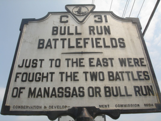
Just to the East were fought the two battles of Manassas or Bull Run. Conservation and Development Commission 1934.
lat:38.79020 
lat:38.78133 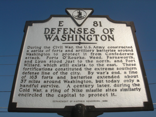
During the Civil War, the U.S. Army constructed a series of forts and artillery batteries around Washington to protect it from Confederate attack. Forts O'Rourke, Weed, Farnsworth, and Lyon stood just to the north, and Fort Willard, which still exists, to the east. These fortifications constituted the extreme southern defense line of the city. By war's end, a line of 163 forts and batteries extended about 37 miles around Washington, but today only a handful survive. A century later, during the Cold War, a ring of Nike missile sites similarly encircled the capital to protect it. Department of Historic Resources, 1999
lat:38.7129 
lat:38.82580 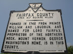
Formed in 1742 from Prince William and Loudoun, and named for Lord Fairfax, proprietor of the Northern Neck. Mount Vernon, George Washington's home, is in this county. Conservation and Development Commission 1929.
lat:38.81962 
lat:38.8196 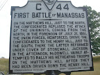
lat:38.83355 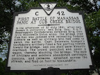
lat:38.93990515797151 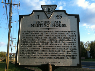
The Frying Pan Meeting House, constructed by 1791 on land donated by the Carter family in 1783, was used for Baptist services until 1968. Named for nearby Frying Pan Branch, the church is a rare example of 18th - century architecture in western Fairfax County. By 1840 the congregation consisted of 33 whites and 29 blacks; both black and white members are buried in the church cemetery. During the Civil War, Union and Confederate forces each used the meeting-house several times as a picket post. The last surviving church trustee conveyed the property to the Fairfax County Park Authority in 1984. Department of Historic Resources. 1994
lat:38.71290 
lat:38.74843 
lat:38.81962 
These are the grounds of the Henry House, where occurred the main action of the First Battle of Manassas, July 21, 1861, and the closing scene of the Second Battle of Manassas, August 30, 1862. Conservation and Development Commission 1935.
lat:38.8196 
lat:38.71170 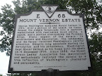
lat:38.79022 
lat:38.79020 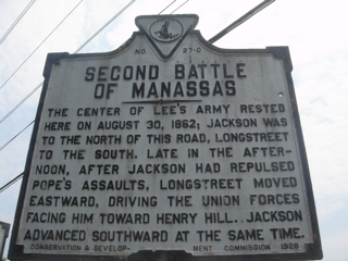
lat:38.82582 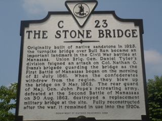
lat:38.71293 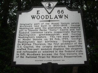
Originally part of the Mount Vernon estate, Woodlawn was built in 1800-1805. George Washington gave the plantation, as a wedding gift to Eleanor Parke "Nelly" Custis and her husband, Lawrence Lewis, respectively Martha Washington's granddaughter and George Washington's nephew. The two were married at Mount Vernon on 22 Feb. 1799, George Washington's last birthday. Designed by Dr. William Thornton, the first architect of the U.S. Capitol, the crisply detailed, beautifully crafted five-part mansion displays the elegance and refinement so admired in the Federal style. In 1951, Woodlawn became the first historic site of the National Trust for Historic Preservation. Department of Historic Resources, 1999 |


|
Although the author has taken all reasonable care in preparing this guide, Mapicurious and the author make no warranty about the accuracy or completeness of its content and accept no responsibility for any loss, injury, or inconvenience arising from its use. |