| This map is found on Mapicurious.com | Download these points of interest directly into your favorite GPS or other geo software | |||
|
|||
| Use the zoom controls on the map to adjust the map's viewable area then print: | |||
| LOCATIONS highlighted on this map: |
|
lat:40.2601179 
lat:40.2586538 
lat:40.2585989 
lat:40.2588874 
lat:40.26119 
lat:40.35157
lat:40.2627955 
lat:40.2636625 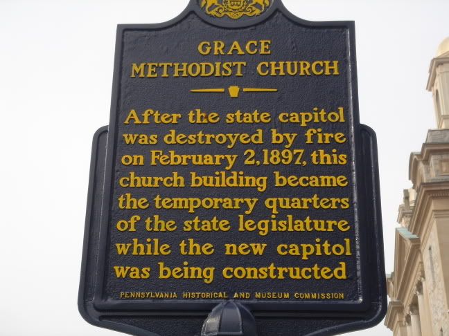
After the state capitol was destroyed by fire on February 2, 1897, this church building became the temporary quarters of the state legislature while the new capitol was being constructed.
lat:40.2622122 
lat:40.2617691 
lat:40.2600674 
lat:40.2644281 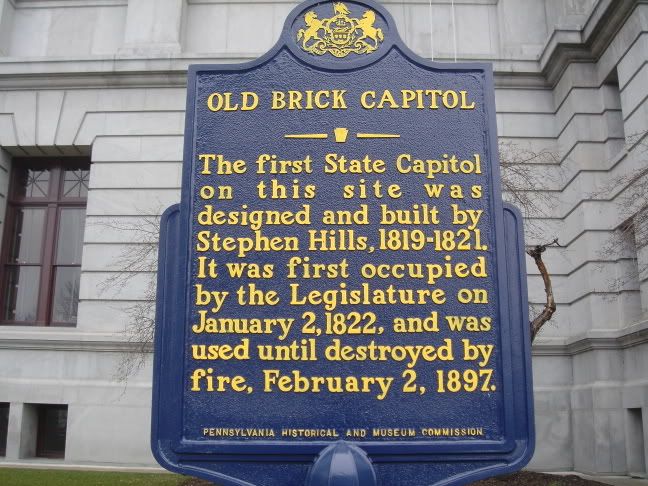
The first State Capitol on this site was designed and built by Stephen Hills, 1819-1821. It was first occupied by the Legislature on January 2, 1822, and was used until destroyed by fire, February 2, 1897.
lat:40.2597018 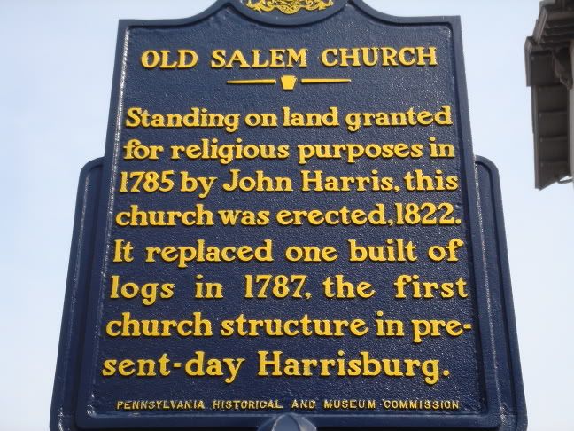
lat:40.32463
lat:40.2642187 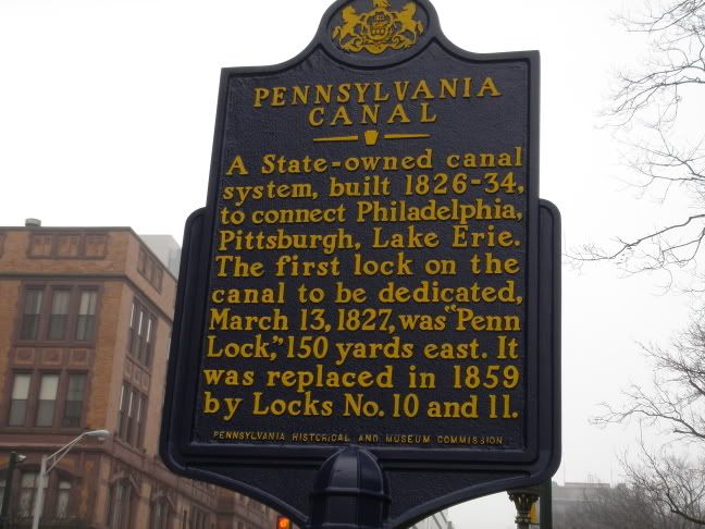
A State-owned canal system, built 1826-34, to connect Philadelphia, Pittsburgh, Lake Erie. The first lock on the canal to be dedicated, March 13, 1827, was "Penn Lock," 150 yards east. It was replaced in 1859 by Locks No. 10 and 11.
lat:40.266075 
lat:40.2641075 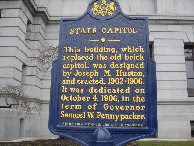
This building, which replaced the old brick capitol, was designed by Joseph M. Huston, and erected, 1902-1906. It was dedicated on October 4, 1906, in the term of Governor Samuel W. Pennypacker.
lat:40.2651647 
lat:40.2654825 
lat:40.2596273 
lat:40.2631383
lat:40.2618704 
|


|
Although the author has taken all reasonable care in preparing this guide, Mapicurious and the author make no warranty about the accuracy or completeness of its content and accept no responsibility for any loss, injury, or inconvenience arising from its use. |